A satellite expected to be released from California later this month will monitor the rising sea level and provide scientists who research how global change impacts the waters of the World with other vital details.
According to Climate.gov, melting ice has already caused sea levels to rise by about 8 inches since 1880. However, the trend is accelerating. NASA added that Earth's oceans soaked up the overwhelming majority of the excess heat. Humans have generated around a quarter of the extra carbon dioxide by burning fossil fuels.
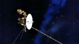
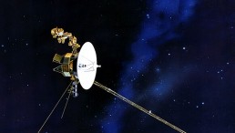
After NASA's former director of Earth Science, the latest Sentinel-6 satellite, dubbed Michael Freilich, will calculate the sea level across the globe for the next five years.
A second satellite of the same kind would take its position at that stage, supplying scientists with accurate data on the Earth's oceans for a whole decade. The project is a NASA-European Space Agency partnership.
The water level starts to increase, said Josh Willis, the mission's project scientist at NASA's Jet Propulsion Laboratory. He told NPR that the space agency is remaking the climate and rising sea levels higher and higher.
The newest in a parade of sea level monitoring missions stretching back to the early 1990s is the satellite. With two state-of-the-art satellites over ten years, the Sentinel-6 project is an example of how much demand there is for accurate high-resolution climate change results.
"Sea level is continuing to rise and we can't stop measuring it," says Josh Willis, the mission's project scientist at NASA's Jet Propulsion Laboratory. "Every year, every decade, we're remaking the climate and rising sea levels higher and higher."

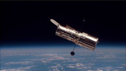
The International Space Station and the docked space shuttle Endeavour orbit Earth during Endeavour's final sortie in Space
How will NASA measure sea levels from outer space?
Sentinel-6 can orbit up to 800 miles and utilize radar to calculate the ocean's crust. A radar pulse is transmitted down to Earth by an instrument on a satellite. The radar bounces off the ocean's surface and returns back to the spacecraft.
Scientists would calculate how far distant the surface of the ocean is from the satellite by calculating how long it takes for the radar to go down and back and allowing for moisture in the environment that slows the radar down.
In other terms, the satellite will inform Earth scientists how big the oceans are and how, over time, the height varies.
"We know that the oceans are rising because of human-caused interference with the climate. And, to see that, you really have to see a sea-level rise over the entire planet," Willis says. "That is what this satellite does best."
Effects of rising waters
Rising waters affect coastal regions of the US in destructive ways. Ocean water in the Chesapeake Bay, Gulf of Mexico, and Pacific coasts has invaded sewage networks, flooded highways, and eliminated whole island towns from life.
Yet, residents further from the coasts are often influenced by the higher, cooler water. What exists in the oceans should not remain in the oceans. Ocean tides and temperatures, for instance, control the atmosphere and fish stocks.
By knowing the sea level, Thompson said experts would have an indication of how much the ocean has expanded because of warming.
Scientists really don't know a thing about how the waters could shift in the coming decades. Climate forecasts are explicit that sea levels will begin to increase gradually, and when the Earth becomes hotter, the rise of sea levels will intensify. But it needs accurate, continuous data from both satellites and tide gauges down on Earth to see just what it would be like at the local level.
ALSO READ: Ireland to Plant Over 400 Million Trees By 2040
Check out more news and information on Climate Change on Science Times.