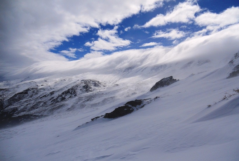
Images captured by the Moderate Resolution Imaging Spectroradiometer (MODIS) of NASA's Terra satellite revealed that the Sierra Nevada mountains had an unusual level of snowfall this year.
Unusual Snowfall in the Snowpack
The Department of Water Resources (DWR) in California says that the snowpack in the Sierra Nevada mountains was 110% of the average for that date. This is as of April 1.
The images taken by the MODIS show the snowpack levels on April 2. According to experts, this close-to-average snowpack is quite strange. The mountain range has recently seen exceptionally high or low snowpack levels in the past decade.
Hydrologist Noah Molotch from NASA's Jet Propulsion Laboratory and the Institute of Arctic and Alpine Research says that when it comes to the Sierras, nothing is typical. This year, as it is nearing 100% of the average, this is considered atypical.
NASA: A “Surprisingly Average” Year for Sierra Snowpackhttps://t.co/1xNvwkPNJQ pic.twitter.com/o0I9IQY995
— SnowBrains (@SnowBrains) April 12, 2024
ALSO READ: Gray Wolf Pack Found in Southern Sierra Nevada Mountains After Being Driven Out in the Early 1900s
Snowpack Levels
Last year, the snowpack levels saw 232% of the average on April 1, the highest snowpack in the previous 70 years. In 2022, its levels were just 35% of the average on April 1.
The extent and thickness of annual snowpack levels could depend on the winter season's dryness or wetness. The snowpack is usually substantial in wet winters, such as those of 2023 and 2017. However, deficient snowpack levels were observed in prolonged dry and hot weather conditions in Nevada and California.
From 2015 to 2016, the El Niño led to significant snow and rain on the mountains. However, the snow levels stayed under the long-term average. From October 2016 until April 2017, atmospheric river events doubled the Sierra Nevada's average precipitation.
Aside from a 2019 surge, snowfall generally stayed below average from 2018 until 2022. From 2020 to 2023, the western US experienced a severe drought mainly because of the La Niña. As the weather effect diminished in early 2022, various atmospheric river events triggered a remarkably wet winter across California.
Since 2010, the snowpack level has not reached such a close-to-average level.
While this year's snowpack level may appear lower than average (with just 37% to 53% of the average on February 1), various atmospheric storms that hit the state in March and February triggered snowfall in the mountains, causing the snowpack level to jump upwards.
El Niño and La Niña
El Niño and La Niña are climatic conditions that comprise a more significant pattern called the ENSO (El Niño-Southern Oscillation). El Niño happens when the sea surface temperatures in the eastern and central Pacific Ocean end up significantly warmer compared to average. This could lead to wetter conditions across the southwest US. It may also result in drier conditions in Australia and Southeast Asia.
On the other hand, La Niña is characterized by temperatures of the sea surface that are cooler than average in the eastern and central Pacific Ocean. This typically results in dry conditions across the southwest US and heightened rainfall in Australia and Southeast Asia.
RELATED ARTICLE: Zombie Forests: 20% of Trees in California Sierra Nevada Is No Longer Compatible With the Climate They Live
Check out more news and information on Environment & Climate in Science Times.


