Google Earth is a fantastic, albeit eerie, tool to zoom in on different parts of the globe. It's beautiful for getting directions, organizing ahead of time for trips, and even spying on your crushes (by the way, don't do that).
However, this geobrowser isn't excellent for taking virtual journeys around the world at 1 a.m., especially given the internet's ability to play on your worst anxieties.
Many people have discovered that satellites can pick up on more than just fascinating mountain shapes and perplexing highways once the service became available to the general public.

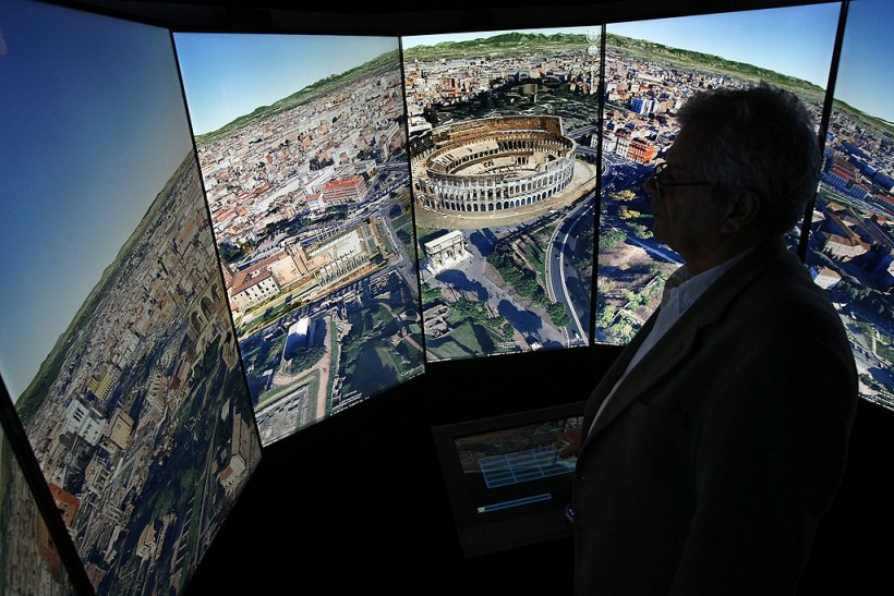
BERLIN, GERMANY - SEPTEMBER 26: A visitor looks at a three-dimensional rendering of Rome while using Google Earth software on September 26, 2012 at the official opening party of the Google offices in Berlin, Germany. Although the American company holds 95% of the German search engine market share and already has offices in Hamburg and Munich, its new offices on the prestigious Unter den Linden avenue are its first in the German capital. The Internet giant has been met with opposition in the country recently by the former president's wife, who has sued it based on search results for her name that she considers derogative. The European Commission has planned new data privacy regulations in a country where many residents opted in to have their homes pixeled out when the company introduced its Street View technology.
5 Creepiest Google Earth Photos
It's fascinating to experience the world through the eyes of Google Earth. Imagine the odd and funny inventions that the general people have come up with.
1. Sprawling Swastika
In Central Asia, scientists in northern Kazakhstan discovered more than 50 geoglyphs, including this swastika-shaped artwork. Unlike the swastika sign, however, many geoglyphs were made of clay mounds. Timber is used to make the Swastika sign.
LiveScience said the area's geoglyphs appear to be at least 2,000 years old, if not older. Swastikas were widely used in Europe and Asia at the time, and they were unrelated to any political viewpoint.
Over 50 ancient #geoglyphs, including #swastika, discovered in #Kazakhstan - See more at: http://t.co/GVQDpW5L5I pic.twitter.com/YjjkE67dzf
— . (@ancientorigins) September 23, 2014
2. Creepy Bunny
This is rumored to be a giant pink bunny from Italy, Twitter netizens claim. It looks spooky from above, and it's not a rabbit that looks like any of our old stuffed bunnies. Maybe it comes to life at night? (Shiver).
Giant Pink Bunny, Prata Nevoso, Italy Weird Google Earth pic.twitter.com/vCJWMJHxXf
— Weird Google Earth (@wrd_googleearth) December 7, 2018
3. Phantom Sandy Island
In 2012, a group of Australian researchers "shrouded in mystery" an island the size of Manhattan in the South Pacific. Sandy Island, located northwest of New Caledonia, had been marked on maps as an unusual location. It appears as a black polygon on Google Earth. However, when scientists arrived in November 2012, they found open sea instead of solid ground.
In an obituary for the island published in April 2013, the research explains why the phantom land had been included on some maps for more than a century, citing human mistake and a possible pumice raft.
SANDY ISLAND || The land mass which seems to be blackened out on Google Earth. Does it exist? | @SBSnews 630 pic.twitter.com/iSw7iLuz
— Ricardo Gonçalves (@BUSINESSricardo) November 23, 2012
4. Pentagram Alert
A gigantic pentagram, measuring around 1,200 feet (366 meters) in diameter, has been etched into the Earth's surface on the wind-blown steppes of Central Asia, in an isolated corner of Kazakhstan.
The five-pointed star encircled by a circle, located on the southern side of the Upper Tobol Reservoir, shows out brightly on Google Maps, the online counterpart of the more comprehensive Google Earth.
A large, mysterious pentagram in remote area of Kazakhstan seen on Google Maps. Info: http://t.co/gSGJCBdTkU pic.twitter.com/QAYoQofbUf
— Cliff Pickover (@pickover) July 21, 2015
Many comments on the web linked it to devil worship, malevolent religious sects, and subterranean dwellers. Instead, the pentagram is shown to be the boundary of a park in the shape of a star, with streets now lined with trees, making the star shape even more visible in aerial pictures.
5. Deceased Loved Ones Revisited in Time
Twitter users commented that they normally go to Google Maps to see their missing loved ones, not for directions or a glimpse of their neighborhood. Dawn wrote in a tweet that his wonderful father died in 2013, yet she still sees him on Google Maps.
My lovely lovely Dad who died in 2013 still on google maps ❤️ pic.twitter.com/qduLLyhqli
— Dawn (@dawn1968) June 17, 2021
Other people responded to her tweet with similar thoughts about how they still get to see their loved ones.
A Twitter user named Seán shared a photo of his parents going along the street holding hands in 2009. He said he lost both of his parents eight and six years ago.
The fact that their images are on display for literally the entire world to see is strange, but it provides their living loved ones a sense of serenity.
RELATED ARTICLE: 5 Strange Sights You'll Find on Google Earth: From Phantom Islands to Unexcavated Pyramids
Check out more news and information on Space in Science Times.


