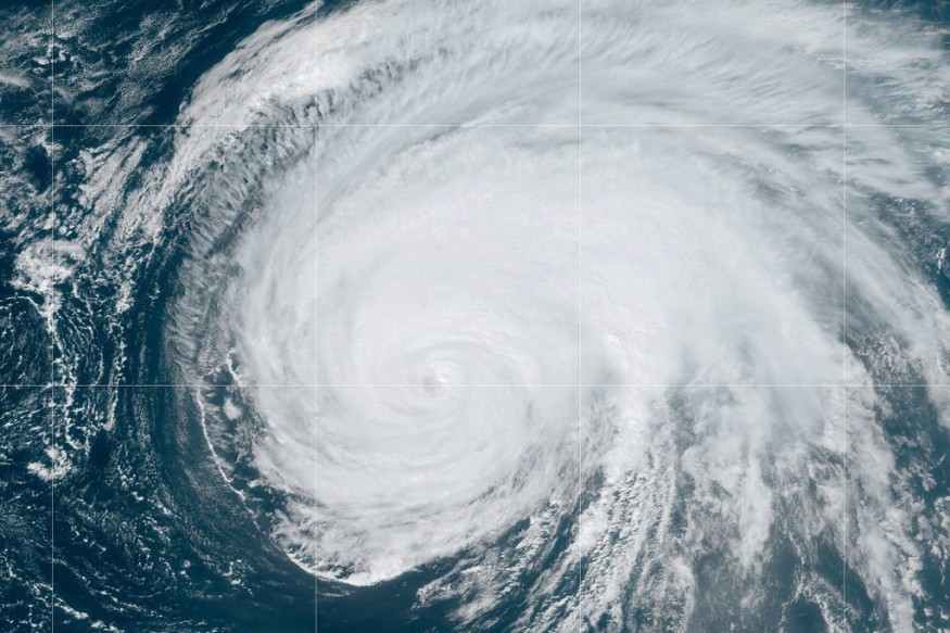
Hurricane Lorenzo is a one of a kind storm. As a category 5 storm, it was the first hurricane to gain such strength so far north, as well as so far east, in the Atlantic Ocean.
Appearing on the radar as a mere tropical storm just a little more than week ago, it only took a couple of days for Lorenzo to become a full-fledged hurricane, reaching a status of category 5 just this past Saturday.
At the height of Lorenzo's power, the storm boasted some rather impressive attributes. Other than the fact that no category 5 hurricane had ever been recorded in such extreme north-eastern waters, Lorenzo's maximum sustained winds reached speeds of 160 miles per hour with exceeding gusts, and the storm was reported to be moving at a speed of roughly 10 miles per hour on a northwesterly trajectory.
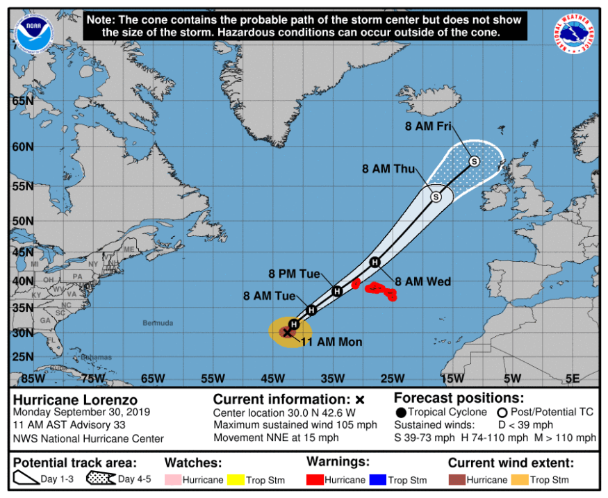
According to the National Hurricane Center and Central Pacific Hurricane Center, Lorenzo exhibited hurricane-force winds that extended as far as 50 miles from the center of the storm and tropical-storm-force winds that extended as far as 275 miles outward.
Although Lorenzo has now dwindled down to just a slightly less threatening category 2, it could still have a significant impact on areas close to Portugal. The winds are also believed to possibly be felt as far as Ireland and the United Kingdom.
Meteorologists are advising the estimated 250,00 residents of Azores, an archipelago of Portugal, that the storm could make land fall as early as tonight or tomorrow morning and people should take cover and brace themselves.
"This is something totally unusual for this kind of environment," said Miguel Miranda, president of the Portuguese Institute of the Sea and Atmosphere. "Most of the infrastructure is not really prepared for this kind of situation."
The Portuguese Institute has issued a hurricane warning for the central and western Azores areas, saying that flash flooding is possible due to heavy rainfall and could prove to be life threatening to the people of the Azores.
Local government officials have also met and discussed public safety works. President of the Azorean regional government, Vasco Cordeiro, released this statement:
"Proper steps are being taken in the areas of public works, transport, social solidarity, housing, health and education, among other sectors, in addition to the actions that are being carried out by the Azores Region Civil Protection and Fire Service."
Although the path of Lorenzo is not a rarity for this time of year, the sheer size and strength of Lorenzo paired with its location is. Andrew Latto, a hurricane specialist at the National Hurricane Center, explained to the New York Times that there is no simple explanation for Lorenzo's strength and behavior.
"You had warm waters, low shear, and there's a decent amount of moisture," he said. "It's a delicate balance."
© 2026 ScienceTimes.com All rights reserved. Do not reproduce without permission. The window to the world of Science Times.


