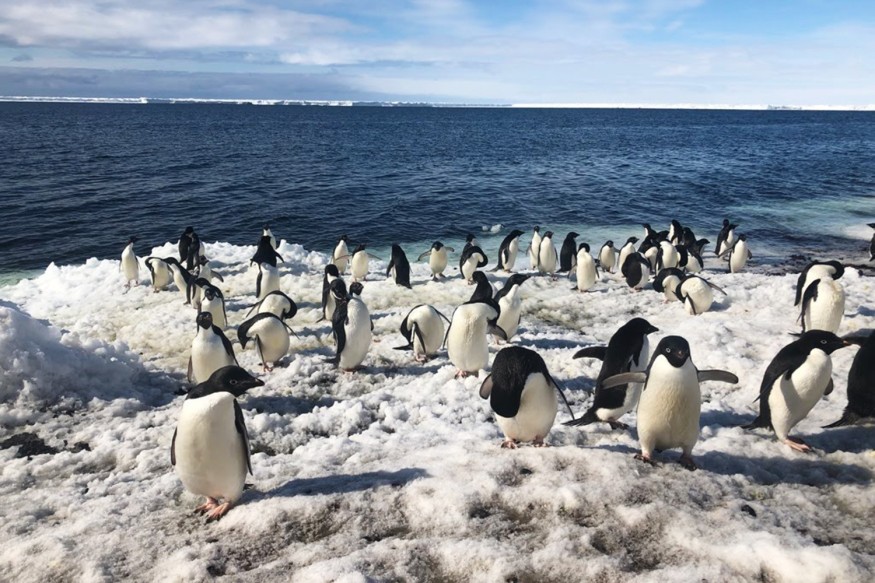
Stanford University's multi-drone imaging system was tested in Antarctica to survey colonies of nearly one million Adelie penguins. Their new research is found in the journal Science Robotics.
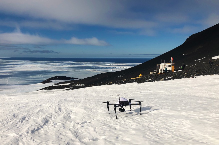
Graduate student Kunal Shah tested the new system made of several high-end autonomous drones at the McMurdo Station. Shah described the start of his two-and-a-half-month stay in Antarctica, saying that it was too cold for the drone batteries and remote control to work. His phone was also too cold and flashed warnings.
Soon, the team made visual surveys of one penguin colony with 300,000 nesting pairs at Cape Crozier. They also observed Cape Royds which was home to nearly 3,000 nesting pairs.
Previous drone surveys at Cape Royds would take up to two days. The new system, alongside the National Science Foundation (NSF) and U.S. Antarctic Program (USAP), was completed in less than three hours. Two to four autonomous drones had route planning algorithms for efficient coverage of the area.
Penguin Colony Survey
The Path Optimization for Population Counting with Overhead Robotic Networks (POPCORN) plans the paths for the aerial photographic surveys. Previous methods of surveying penguin colonies were done via helicopters or just one drone.
Although the helicopter method resulted in good image quality, it is expensive, fuel-inefficient, and could disturb the penguins. Using a single drone is time-consuming and difficult to navigate in the present conditions. Drones also have a limited battery life of up to 15 minutes only.

The team's algorithm was designed for the drones to have assigned destination points simultaneously. Shah said that process was quick and efficient. "What had been just the algorithm's squiggles on a screen the day before turned into a massive image of all the penguins in the colonies." The drones also captured people walking around the colonies as well as individual penguins that were nesting or moving to and from the ocean.
Read Also: Must Watch: Drone Captures About 64,000 Turtles Bobbing About at the Great Barrier Reef
Future Applications of the Multi-Drone System
The Stanford team also has other plans for its multi-drone system such as monitoring traffic and wildfires. They've previously done test runs in California to survey land for livestock grazing. The drones were also tested over Mono Lake near the Nevada border to survey the local gull population. During the gull population survey, they had to take a boat to reach the site and the drones were at risk of falling into the lake.
Meanwhile, in Antarctica, penguin biologists measured the sizes of colonies, birth rates, and nesting density. They will soon be conducting another round of penguin observations before 2021.
Mac Schwager, who got involved with Point Blue Conservation Science and studying penguins back in 2016, said that the new drone system is a powerful tool to help manage the changing world and environment "at a scale that we never could before. Humans could never leap into the sky and count 300,000 penguins or track a forest fire."
Check out more news and information on Drones on Science Times.
© 2026 ScienceTimes.com All rights reserved. Do not reproduce without permission. The window to the world of Science Times.


