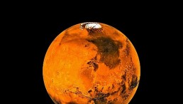
Humans use satellites to capture images of space and study what lies beyond the Solar System. But satellite imagery also shows pictures of Earth's landscape and other things that happen on the surface. For instance, space agencies have shared photos of thunderstorms and volcanic eruptions as seen from space that looks different than being experienced on Earth.
Recently, the Pacific Island nation of Tonga experienced a devastating volcanic eruption that had catastrophic impacts across the globe, like a tsunami and an oil spill in Peru. Here are some of those photos taken via satellite from space.

Aerial view of cleaning crews working to remove oil from a beach annexed to the summer resort town of Ancon, northern Lima, on January 22, 2022, after a spill that occurred during the offloading process of the Italian-flagged tanker "Mare Doricum" at La Pampilla refinery caused by the abnormal waves recorded after the volcanic eruption in Tonga.
Peru Oil Spill in the Aftermath of Tonga Volcanic Eruption
Maxar Technologies, a space technology company, shared satellite imagery of the Peruvian oil spill last month after the Tonga volcanic eruption. BBC News reported that this happened when a tanker at the La Pampilla refinery was hit by waves caused by the Tonga volcanic eruption.
An oil spill off the Peruvian coast has caused an ecological disaster authorities have said.
The #LaPampilla refinery has leaked over 6,000 barrels of oil after a tanker was hit by waves linked to Tonga's volcanic eruption on Saturday
🛰@Maxar#Ventanilla #Chancay #Peru #OilSpill pic.twitter.com/I6nlBvIrjU— Worldview earth data🌱 (@WED_explorer) January 21, 2022
Environment minister Ruben Ramires said that nearly 12,000 oil barrels leaked into the sea on January 15, causing an ecological disaster that killed local fish and seabirds. The site is about 19 miles (30 kilometers) north of Lima and is owned by Spanish oil company Repsol. The satellite imagery from Maxar showed the extent of the Peruvian oil spill that has spread to more than 20 beaches over 25 miles (41 kilometers) of coastline. The oil spill has even spread to the protected area of the Ancón Reserved Zone and the similarly biological valuable Pescadores Islets. The government of Peru has demanded compensation from the company for its role in the incident. This has been called the worst oil spill in the country's history, whose economy relies heavily on fishing.
Mount Etna Eruption 2022
Not a very clean shot since there is way too much humidity in Europe’s air at the moment but @astro_luca's home volcano #Etna is clearly smoking (and spitting lava as I learnt from the news) 🌋 pic.twitter.com/gL5uNOkZUy
— Matthias Maurer (@astro_matthias) February 12, 2022
The crew aboard the International Space Station (ISS) shared photos of the recent Mount Etna eruption as it continues to spew ashes into the air, Space.com reported.
European Space Agency (ESA) astronaut Matthias Maurer posted on Saturday on his Twitter account some photos of the eruption as seen from space in which he captioned: "Not a very clean shot since there is way too much humidity in Europe's air at the moment, but @astro_luca's home volcano #Etna is clearly smoking (and spitting lava as I learnt from the news) "
Astronauts and satellites observe Mount Etna in space because of being quite active the past year and accumulating lava flows that allowed it to grow by 100 feet (30 meters) in a few months.
Seeing Sunrise From Space
Last month, NASA shared the first orbital sunrise of the day as seen from the ISS as it orbited 257 miles above the coast of Venezuela. The space agency said that capturing sunrises and sunsets from the space laboratory does not necessarily mean waking up at dawn. The ISS completes one trip around Earth every 92 minutes, giving them 15-16 chances of seeing sunrises and sunsets every day.
RELATED ARTICLE: Satellite Imagery Reveals World's Glaciers Melting Fast, Threat to Sea Levels Raised
Check out more news and information on Tech & Innovation in Science Times.