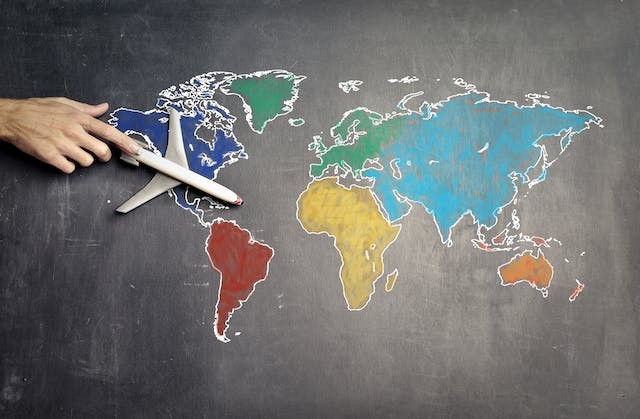
The standard world maps that have been used in classrooms to study geography are reportedly not accurate. And if you know why it's difficult to come up with an accurate one, you'll probably understand.
True Accurate Real World Map
Cartographers have been trying to construct the most accurate map of the Earth for centuries, and they have made several attempts to account for the irregularity. Maps are compromises between representing the relative size of the continents and oceans and distorting the angles of latitude and longitude lines.
While some were designed specifically to locate the topographical sweet spot, others had other goals in mind when they designed the map. The issue was so pervasive that a French mathematician created an equation bearing his name to express the extent of deformation a global map underwent. The equation, known as Tissot's indicatrix, is shown by circles spaced regularly throughout a map. The amount to which the continents are being pulled and stretched out of shape on the map can be calculated by calculating the deformation of each circle.
Cartographers came up with different projections of the Earth, including the Sinusoidal projection, Robinson projection, Bonne projection, and Armadillo projection. However, the most accurate was reportedly Japan's prestigious Good Design.
Our spherical globe can now be contained within a rectangular box thanks to design innovations. The globe was divided into 96 sections by Tokyo-based architect and artist Hajime Narukawa, who then folded the regions into a tetrahedron, a pyramid, and a two-dimensional sheet.
By tilting the continents outward rather than expanding them, the multi-step technique maintains the illusion that they are all arranged vertically, as we are accustomed to. The intention was to produce a map that more correctly captured the appearance of regions close to the poles, making it more appropriate for addressing 21st-century issues such as fast melting sea ice and territorial claims of marine territory.
The result was the AuthaGraph world map, which looked a little different than what we were familiar with.
Real World Map. Vs. Fake
One netizen compared two maps on TikTok and claimed that the world map most know was wrong. For instance, Africa was reportedly shown to be smaller than its actual size. He also emphasized that in the real map, Sweden, Finland, and Norway were much smaller, and Greenland was also tiny. However, the man didn't mention what maps he used in the comparison.
Sophia Smith Galer added that the world map we usually see is based on the Mercator projection from the 1500. According to her, it was used to help people navigate seas and wasn't meant to represent land masses accurately. Some countries were reportedly represented as bigger than they truly are
Another user pointed out that based on the traditional map, Iowa is near the equator and should have a semi-tropical climate, which isn't the case. The user concluded that the traditional map was wrong.
The netizen showed the "real version" of the world map. According to her, the sizes and shapes of the countries projected on the map she was holding were accurate. She pointed out Greenland, which is represented as a tiny country, on the projection map to support her point.
RELATED ARTICLE: 1,600-year-old Roman Dodecahedron Unearthed in Belgium: What Were Those Ancient Objects Used For?
Check out more news and information on Design in Science Times.
© 2026 ScienceTimes.com All rights reserved. Do not reproduce without permission. The window to the world of Science Times.


