A higher than normal heatwave has struck Greenland, subjecting its ice sheet to a massive melting event, with an ice melt supposedly enough to cover the entire state of Florida with water.
Danish researchers who have been monitoring the site since Wednesday, July 28, have noted that the vast ice sheet covering the Arctic location has already melted at a rate of about 8 billion metric tons each day. This year's massive melting event is almost twice the normal average during summertime, the researchers reported via the Polar Portal, the platform run by Danish research institutions monitoring the Greenland Ice Sheet and the sea ice surrounding the Arctic.
Read also: Melting Polar Ice Caps: What are Its Effects on the Earth's Rotation? Here's What Expert Says
Runoff Enough To Cover Florida
According to the Danish Meteorological Institute, parts of the ice sheet have registered temperatures of more than 68 degrees Fahrenheit (20 degrees Celsius), which is more than twice the normal average summer temperature. Additionally, Nerlerit Inaat airport, located in Sermersooq in easter Greenland, recorded 74.1 degrees Fahrenheit (23.4 degrees Celsius) - the highest temperature logged since the airport started recording.
In its Twitter update, the Polar Portal explains that the recent massive melting event is "enough to cover Florida with two inches of water." It also noted that while it's not yet as severe as the 2019 melt in terms of gigatons of ice, the area affected by the ongoing melt is slightly larger than that from two years ago.
In 2019, the Greenland Ice Sheet saw its greatest recorded ice loss. According to NASA, it shed 532 billion tons of ice, surpassing 463 billion tons of ice melted back in 2012. A 2020 study published in the Communications Earth & Environment journal reported the melt using data from the Gravity Recovery and Climate Experiment - Follow On (GRACE-FO) satellite mission.
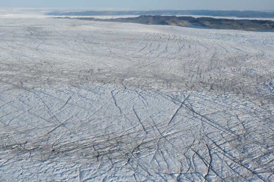
The Greenland Ice Sheet
The massive Greenland Ice Sheet covers about 660,000 square miles (1.7 million square kilometers) of land area, equivalent to almost 80% of the nation of Greenland. It is currently the second-largest ice sheet left on Earth, after the larger Antarctic Ice Sheet.
Rapid melting of the Greenland Ice Sheet has been recorded at least since the 1990s, with an accelerated rate noted since 2000. Polar Portal researchers say that the mass lost from the ice sheet in recent years is about four times as much as the cumulative losses from before 2000. According to the 2001 document Climate Change 2001: The Scientific Basis from the IPCC, should the Greenland Ice Sheet melt completely, it would raise the ocean levels around the world by 24 feet (7.2 meters).
Another study, published in the Nature Communications Journal, examines the recent Greenland Ice Sheet contributions to global sea-level rise in the context of the CMIP 6 design, an experimental framework that assesses multiple climate change models, considering a variety of factors to assess their effect. It suggested that at the rate it is going, ocean levels could see an increase of about 10 to 18 centimeters by 2100, an estimate 60% faster compared to previous estimates.
However, researchers are optimistic about the cool start to this year's summer season, making the ice retreat this year still within historically acceptable values.
Check out more news and information on the Greenland Ice Sheet in Science Times.
© 2026 ScienceTimes.com All rights reserved. Do not reproduce without permission. The window to the world of Science Times.


