NASA and ESA work together to conduct aurora satellite imaging to study these phenomena. These are shimmering lights in the night sky created when charged particles from the Sun interact with Earth's magnetic field and upper atmosphere.
These displays are most common near the polar regions, where Earth's magnetic field lines funnel energetic particles into the atmosphere and trigger glowing curtains, arcs, and spirals of light.
Studying auroras helps scientists understand how energy from the Sun flows through Earth's magnetosphere and ionosphere. This is not just a matter of visual beauty; the same processes that create auroras are closely linked to space weather that can affect satellites, communications systems, navigation signals, and even power grids on the ground.
How Satellites Capture Aurora Images From Space
Satellite aurora imaging is one of the most powerful ways to examine the structure and evolution of auroras on a global scale. From orbit, satellites can view the entire auroral oval around each pole, capturing patterns and changes that would be impossible to see from a single ground location. These spacecraft often carry ultraviolet, visible, and sometimes infrared cameras, along with particle detectors and magnetic field instruments.
Because they move above the atmosphere, satellites are not affected by clouds or weather and can observe auroras both on the night side and, using non‑visible wavelengths, on the day side. High‑cadence satellite aurora imaging allows scientists to watch how the auroral oval expands and contracts during geomagnetic storms, track fast‑moving auroral arcs, and link these changes to conditions in the solar wind and the magnetosphere.
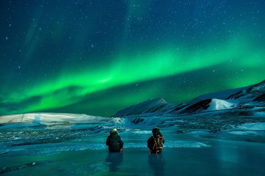
Ground-Based Aurora Cameras and All-Sky Imagers
While satellites deliver the big picture, ground‑based aurora cameras fill in fine detail and provide continuous coverage from key locations. All‑sky cameras at high‑latitude observatories capture the entire sky above them, recording how auroral arcs, bands, and patches appear and move from the surface. These imagers offer high spatial and temporal resolution, which is ideal for studying small‑scale structures and rapid variations.
Ground aurora networks often share data with both NASA and ESA teams. Because the cameras are fixed and well‑calibrated, they are valuable for validating and interpreting satellite aurora imaging.
By comparing what a satellite sees from above with what cameras see from below at the same time, scientists can ensure that their instruments are correctly calibrated and can link image features to specific atmospheric altitudes and conditions.
Radars, Magnetometers, and Other Ground Sensors
Beyond cameras, networks of ground‑based radars and magnetometers play a central role in auroral science. Specialized radars probe the ionosphere, measuring the motion of charged particles and revealing flows associated with auroral electrojets and convection patterns. Magnetometers, scattered across high and mid‑latitudes, record subtle changes in Earth's magnetic field caused by electric currents flowing in the upper atmosphere.
When these ground sensors are combined with satellite aurora imaging, the result is a multidimensional view of auroral events. Satellite images show where auroras brighten and move, radars reveal plasma flows, and magnetometers indicate how strong the associated currents are. Together, these datasets allow researchers to reconstruct how energy from the solar wind enters the magnetosphere and is ultimately dissipated in the upper atmosphere.
Sounding Rockets and Balloon Experiments
Sounding rockets provide another window into the auroral environment. These suborbital rockets are launched directly into auroral displays and carry instruments that measure particles, electric fields, magnetic fields, and atmospheric chemistry along their brief trajectories.
Because they pass directly through active auroral structures, they can sample small‑scale features that neither satellites nor ground instruments can resolve in as much detail.
High‑altitude balloons complement this approach by lifting instruments into the stratosphere, where they can monitor the upper atmosphere's response to auroral energy input over longer periods.
Although their altitude is far below that of satellites, balloons can carry sensitive detectors and help link ground measurements with the broader context provided by space‑based platforms. These targeted campaigns often operate in coordination with both NASA aurora research teams and European partners.
Combining Space and Ground Data
The most comprehensive view of auroras emerges when satellite aurora imaging and ground‑based measurements are carefully coordinated. During planned campaigns or major geomagnetic storms, multiple satellites, radars, cameras, and magnetometers focus on the same region simultaneously. This coordinated approach enables connecting global dynamics with local physical processes.
Data from these efforts are then assimilated into sophisticated computer models that simulate the magnetosphere–ionosphere system. NASA aurora research groups and ESA space weather teams both rely on such models to interpret observations and to test how different solar wind conditions might produce particular auroral responses. The insights gained help refine forecasts and improve the reliability of operational space‑weather services.
What Is Space Weather and Why Does It Matter?
Space weather refers to the changing conditions in space driven by the Sun, including solar flares, coronal mass ejections, high‑speed solar wind streams, and the associated disturbances in Earth's magnetic environment.
Auroras are often the most visible sign that space weather is active, but the same disturbances can pose risks to technology. Enhanced currents and radiation can disrupt satellite electronics, degrade radio communications, disturb GNSS navigation, and induce currents in long power lines.
By focusing on auroras as both a research target and a diagnostic tool, NASA aurora research and ESA space weather programs aim to provide earlier warnings and better risk assessments. Understanding how auroral intensity and motion correspond to specific types of geomagnetic storms helps turn raw observations into actionable forecasts that operators can use to mitigate impacts.
Future Directions in Aurora and Space Weather Research
The future of auroral research points toward more comprehensive and higher‑resolution observations. Planned and proposed missions emphasize improved satellite aurora imaging with better spatial and temporal resolution, as well as constellations of small satellites that can sample multiple regions simultaneously.
Such systems will allow scientists to trace the evolution of auroral structures more precisely and link them to changes in the solar wind and magnetosphere.
On the ground, expanding networks of cameras, radars, and magnetometers, combined with citizen‑science aurora reporting, will enrich the data available to researchers. As data volumes increase, advanced modeling and machine‑learning techniques will play a larger role in interpreting observations and improving forecast skill.
In this evolving landscape, NASA aurora research and ESA space weather programs will remain central players, using auroras as both a scientific probe and a practical tool for understanding and managing the space environment surrounding Earth.
Frequently Asked Questions
1. Can auroras be used to test and improve satellite designs?
Engineers can use knowledge of auroral activity and related space weather conditions to test how satellite components respond to radiation, charged particles, and geomagnetic disturbances. By simulating the energetic environments that occur during strong auroral events, they can refine shielding, electronics design, and fault‑tolerance strategies for future spacecraft.
2. Do auroras affect GPS accuracy and aviation operations?
Strong auroral and geomagnetic activity can disturb the ionosphere, the region that GPS signals travel through, which can lead to temporary degradation in positioning accuracy. In aviation, especially on polar routes, enhanced auroral conditions may prompt airlines and air traffic controllers to adjust flight paths or communications strategies to maintain reliable radio links and navigation performance.
3. How do scientists decide where to place ground-based aurora instruments?
Researchers select locations for aurora cameras, radars, and magnetometers based on how often auroras occur there and how well the site complements existing coverage. High‑latitude regions under the typical auroral oval are prioritized, but networks are also spread longitudinally so that scientists can track how auroral and geomagnetic disturbances move around the globe over time.
4. Can citizens contribute useful data to aurora and space weather research?
Citizen observers can provide time‑stamped photos, visual reports, and brightness estimates of auroras that supplement professional networks. When combined with satellite and ground‑sensor data, these crowdsourced observations help fill geographic gaps, verify the extent of auroral events, and improve public space‑weather awareness.
© 2026 ScienceTimes.com All rights reserved. Do not reproduce without permission. The window to the world of Science Times.


