Thunderstorms are among the most dynamic weather events on Earth, evolving from harmless-looking clouds into powerful systems capable of producing intense rain, lightning, and even tornadoes.
Understanding thunderstorms and their progression, from small cumulus clouds to towering cumulonimbus giants, offers insight into how atmospheric conditions drive thunderstorm development and, in extreme cases, supercell formation.
What Are the Early Stages of a Thunderstorm?
Thunderstorms begin with something deceptively simple: warm, moist air rising into the atmosphere. This process typically starts on a warm day when the sun heats the ground, causing air near the surface to become less dense and rise. As it rises, the air cools, and water vapor condenses into tiny droplets, forming puffy cumulus clouds.
At this stage, the clouds may appear harmless. However, the environment plays a key role in determining whether these clouds remain small or grow into thunderstorms. If the atmosphere is unstable, meaning warm air continues to rise rapidly, the cloud can grow vertically, setting the stage for further thunderstorm development.
How Do Cumulonimbus Clouds Form?
As rising air continues to feed the cloud, it transitions into a cumulonimbus cloud, the hallmark of thunderstorms. These clouds can tower up to 10–12 kilometers high, reaching into colder regions of the atmosphere.
Cumulonimbus clouds form when three key ingredients come together: moisture, lift, and instability. Moisture provides the water vapor needed for cloud formation, lift initiates the upward motion of air, and instability allows that air to keep rising instead of sinking back down.
Visually, cumulonimbus clouds are easy to identify. They often have a towering, cauliflower-like appearance and can develop a flat, anvil-shaped top as they reach the upper atmosphere. At this point, the cloud is no longer just a visual feature, it has become an active thunderstorm system.
The Role of Updrafts in Thunderstorm Development
Updrafts are the driving force behind thunderstorm development. These upward currents of air transport heat and moisture into the growing cumulonimbus cloud, fueling its expansion.
Strong updrafts allow water droplets and ice particles to remain suspended in the cloud, where they collide and grow larger. This process eventually leads to precipitation in the form of rain or hail. Without sustained updrafts, a thunderstorm cannot maintain its structure.
Updrafts also interact with downdrafts, which are downward-moving air currents created when precipitation drags air toward the ground. The balance between updrafts and downdrafts determines the lifespan and intensity of a thunderstorm. When updrafts weaken, the storm begins to dissipate.
What Causes a Thunderstorm to Become Severe?
Not all thunderstorms become severe, but certain conditions can push them into more dangerous territory. One of the most important factors is wind shear, which refers to changes in wind speed or direction with height.
Wind shear can tilt a storm, preventing downdrafts from cutting off the updrafts that sustain it. This separation allows the storm to persist longer and grow stronger. As a result, severe thunderstorms can produce large hail, damaging winds, and frequent lightning.
In contrast, ordinary thunderstorms typically last less than an hour and lack the organization needed to intensify. The presence of strong updrafts combined with wind shear is often the difference between a short-lived storm and a severe weather event.
Stages of Thunderstorm Development
Thunderstorms follow a recognizable life cycle consisting of three main stages.
The first stage is the cumulus stage, where warm air rises and forms cumulus clouds. During this phase, updrafts dominate, and there is little to no precipitation.
The second stage is the mature stage, when the storm reaches its peak intensity. Both updrafts and downdrafts are present, leading to heavy rain, lightning, gusty winds, and sometimes hail. This is when cumulonimbus clouds are fully developed.
The final stage is the dissipating stage. Here, downdrafts take over, cutting off the supply of warm, moist air. Without strong updrafts, the storm weakens and eventually fades away.
Each of these stages plays a role in the broader process of thunderstorm development, illustrating how atmospheric dynamics shape weather patterns.
How Do Supercells Form?
Supercell formation represents the most organized and powerful type of thunderstorm development. Unlike ordinary storms, supercells contain a rotating updraft known as a mesocyclone.
This rotation is primarily caused by strong wind shear. As winds change direction and speed with height, they create horizontal spinning motions in the atmosphere. When a ძლიერი updraft tilts this rotation vertically, it forms a rotating column of air within the storm.
The presence of a mesocyclone allows the storm to sustain itself for several hours, making supercells particularly long-lived. These storms often produce the most severe weather, including large hail, intense winds, and tornadoes.
Supercell formation requires a precise combination of atmospheric conditions, which is why these storms are less common but far more impactful than typical thunderstorms.
Why Are Supercells So Dangerous?
Supercells are considered the most dangerous type of thunderstorms due to their structure and longevity. Their rotating updrafts allow them to maintain strength over long distances, increasing their potential for damage.
One of the most notable threats associated with supercells is tornado formation. The same rotation that defines a supercell can tighten and extend downward, creating a tornado. In addition, supercells can produce hail larger than golf balls and wind gusts exceeding 100 kilometers per hour.
Compared to ordinary thunderstorms, supercells are highly organized systems. This organization enables them to persist and evolve, often affecting large areas over extended periods.
Real-World Examples of Thunderstorm Evolution
Meteorologists often study real-world cases to better understand how thunderstorms evolve into supercells. For example, a typical scenario might begin with scattered cumulus clouds on a गर्म afternoon. As atmospheric instability increases, one of these clouds grows rapidly into a cumulonimbus cloud.
With sufficient wind shear, the storm begins to rotate, transitioning into a supercell. Radar imagery would reveal a distinctive hook echo, a signature often associated with tornado-producing storms.
Satellite data also helps track thunderstorm development, showing how clouds expand vertically and spread outward. These tools provide valuable insights into storm behavior and help improve forecasting accuracy.
From Thunderstorms to Supercells: Understanding the Full Process
Thunderstorms demonstrate how small atmospheric changes can lead to significant weather events. Starting from simple cumulus clouds, the process of thunderstorm development involves moisture, instability, and powerful updrafts that build towering cumulonimbus structures.
In certain conditions, these storms evolve further into supercells, where rotation and wind shear create some of the most intense weather on the planet. By understanding how thunderstorms grow and transform, it becomes easier to recognize the warning signs of severe weather and appreciate the complexity behind supercell formation.
Frequently Asked Questions
1. Can thunderstorms form at night?
Yes, thunderstorms can develop at night if atmospheric conditions like moisture, instability, and lift are present, though they are more common in the afternoon.
2. What tools do meteorologists use to track thunderstorms?
They use Doppler radar, weather satellites, and computer models to monitor storm movement, intensity, and potential hazards.
3. Are thunderstorms more common in certain regions?
Yes, thunderstorms occur more frequently in warm, humid regions such as the tropics and parts of the central United States.
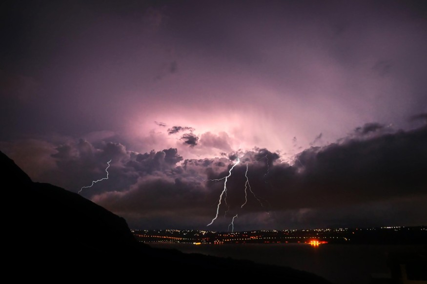
4. How far can lightning travel from a thunderstorm?
Lightning can strike up to about 10–15 miles away from the storm, even if skies appear clear overhead.
© 2026 ScienceTimes.com All rights reserved. Do not reproduce without permission. The window to the world of Science Times.


