Using drones to monitor environmental change is becoming essential in modern conservation. Drones, habitat monitoring, and multispectral imaging now work together to provide faster, more accurate insights into ecosystems under pressure from climate change and human activity.
Through drone habitat mapping and conservation imaging, researchers can track changes in vegetation, land use, and biodiversity with unprecedented detail.
What Is Drone Habitat Mapping?
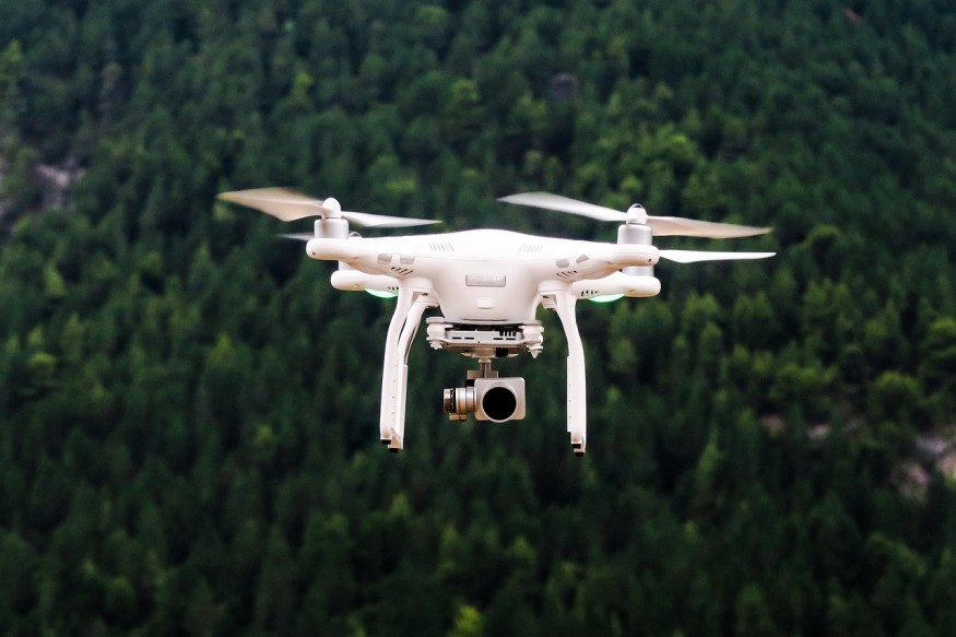
Drone habitat mapping uses unmanned aerial vehicles (UAVs) equipped with cameras and sensors to capture high-resolution images of ecosystems. These images are processed into maps that reveal patterns in vegetation, water systems, and land cover.
Compared to traditional field surveys, drones are faster, more cost-effective, and less disruptive to wildlife. They can also access remote or hazardous areas such as dense forests, wetlands, or mountainous terrain. This makes them a valuable tool for large-scale conservation imaging projects.
How Multispectral Imaging Works
A key technology behind drone mapping is multispectral imaging, which captures light beyond the visible spectrum. In addition to red, green, and blue, multispectral sensors detect near-infrared and red-edge wavelengths.
These extra bands reveal details about plant health. Healthy vegetation reflects more near-infrared light, while stressed plants reflect less. This allows researchers to calculate indices like the Normalized Difference Vegetation Index (NDVI), helping them monitor ecosystem health over time.
In practice, drones collect multispectral data during flight, and software converts it into maps that highlight vegetation condition, moisture levels, and environmental changes.
Why Use Drones for Habitat Monitoring?
The growing use of drones in habitat monitoring comes down to efficiency and precision. Drones can survey large areas in hours instead of weeks, delivering real-time data that supports faster decision-making.
They also improve safety by reducing the need for researchers to enter dangerous environments. At the same time, drones minimize human disturbance in sensitive habitats, which is critical for accurate ecological observation.
This combination of speed, safety, and detail makes drone habitat mapping a practical solution for ongoing environmental monitoring.
Applications of Drones in Conservation Imaging
The role of conservation imaging continues to expand across different ecosystems.
Drones are widely used to track deforestation and habitat fragmentation. They can detect small-scale changes that satellites may miss, allowing for early intervention. In wildlife conservation, drones help monitor animal populations, migration routes, and behavior without intrusive methods.
They are also effective in identifying illegal activities such as logging or poaching. Real-time aerial data allows conservation teams to respond quickly and protect vulnerable areas.
After natural disasters like wildfires or storms, drones assist in damage assessment and recovery planning. Multispectral data helps identify which areas are regenerating and which require support.
Benefits of Multispectral Drone Technology
Combining multispectral imaging with drones offers several advantages. It allows conservationists to detect subtle environmental changes that standard cameras cannot capture.
Early detection of plant stress or disease enables targeted interventions before problems spread. Drones also provide consistent data over time, making it easier to track trends and measure the success of conservation efforts.
Another key benefit is scalability. Large areas can be monitored efficiently, making drone habitat mapping suitable for both local and global projects. As technology becomes more affordable, access to these tools is expanding.
Challenges and Limitations
Despite their benefits, drones have limitations. Regulations can restrict where and how drones are used, depending on the region.
The cost of multispectral sensors and data processing tools can still be high, especially for smaller organizations. In addition, analyzing multispectral data requires technical expertise.
Environmental conditions such as strong winds or dense canopy cover can also affect data quality and flight operations.
How Are Drones Used in Habitat Mapping?
Drones follow pre-programmed flight paths to capture overlapping images of a target area. These images are stitched together using software to create detailed maps.
With multispectral sensors, the data goes further by analyzing light reflectance. This allows researchers to assess vegetation health, detect invasive species, and monitor changes over time.
For example, a wetland survey might use drones to track water levels, plant growth, and ecosystem shifts in a single mission.
What Is Multispectral Imaging in Conservation?
Multispectral imaging in conservation involves capturing multiple wavelengths of light to analyze environmental conditions. It helps scientists evaluate vegetation health, soil moisture, and land changes more accurately than standard imaging.
This technology is especially useful for detecting early signs of habitat degradation, making it a critical component of modern conservation imaging.
Why Is Drone Habitat Mapping Important for Conservation?
Drone habitat mapping improves how conservationists collect and use environmental data. It supports faster, more informed decisions and enables proactive management of ecosystems.
Instead of reacting to visible damage, researchers can identify early warning signs and act before conditions worsen. This is particularly important in fragile habitats where recovery is slow.
The Future of Drones, Habitat Monitoring, and Conservation Imaging
The future of drones, habitat monitoring, and conservation imaging is being shaped by advances in artificial intelligence and data processing. Automated analysis is making it easier to interpret large datasets and detect patterns quickly.
As drones become more accessible, their use in conservation will continue to grow. Improved sensors, longer flight times, and integration with other technologies will further enhance their capabilities.
Why Drones Are Changing Habitat Monitoring
The combination of drones, multispectral technology, and drone habitat mapping is transforming how ecosystems are studied and protected. These tools provide accurate, timely data that supports better conservation strategies.
As environmental challenges increase, conservation imaging powered by drones offers a scalable and effective way to monitor change, protect biodiversity, and manage habitats more sustainably.
Frequently Asked Questions
1. What types of drones are best for habitat mapping?
Fixed-wing drones are ideal for covering large areas, while multirotor drones are better for detailed, small-scale surveys.
2. How accurate is drone habitat mapping compared to satellite imagery?
Drone mapping typically offers higher resolution and more precise local data, while satellites are better for broad, long-term monitoring.
3. Do drones require special permits for conservation use?
Yes, most countries require permits or licenses depending on flight location, altitude, and purpose.
4. How long does it take to process multispectral drone data?
Processing can take a few hours to several days, depending on the size of the area and the complexity of the data.
© 2026 ScienceTimes.com All rights reserved. Do not reproduce without permission. The window to the world of Science Times.


